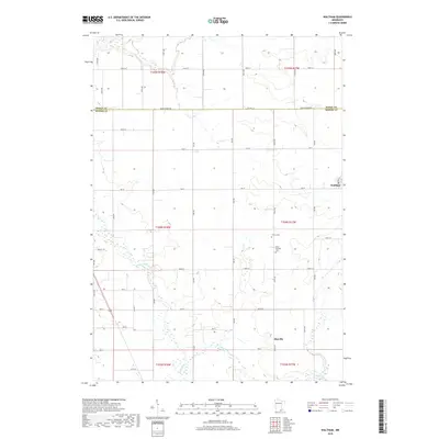
2019 Map of Waltham
USGS Topo · Published 2019About this map
The Cedar River meanders south through the rural landscape of Mower County, defining the agricultural character of this region. The small settlement of Waltham sits on the eastern edge of the quadrangle, with its streets organized around Main St. To the south, the community of Mayville serves as another focal point for the surrounding farmsteads. The land is precisely partitioned by a grid of rural routes, including Dodge Mower Rd and Co Hwy 16, which trace the boundaries between townships and counties. Family and community heritage is anchored by local landmarks such as Trinity Cem and Saint Michael's Cem. The map also captures the path of Roberts Cr, which feeds into the larger drainage system of the river valley.
Find a feature on this map
29 named features on this map. Tap any name to fly to it.
Don’t see what you’re looking for? This feature index may not catch every label — zoom into the map to look around manually.
Map Details
Editions of this 2019 Waltham Map
This is the sole edition of this map. No revisions or reprints were ever made.
Other maps of this area

1954 · Hayward
USGS Topo · 1:62,500

1954 · Austin
USGS Topo · 1:62,500

1954 · Mason City
USGS Topo · 1:250,000

1957 · Mason City
USGS Topo · 1:250,000

1958 · Mason City
USGS Topo · 1:250,000

1966 · Waltham
USGS Topo · 1:24,000

1966 · Hayfield NW
USGS Topo · 1:24,000
1966 · Hayfield
USGS Topo · 1:24,000

1966 · Sargeant
USGS Topo · 1:24,000

1967 · Bixby
USGS Topo · 1:24,000