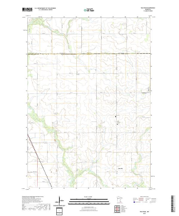
2022 Map of Waltham
USGS Topo · Published 2022About this map
The agricultural landscape of Mower and Dodge counties defines this area of southern Minnesota, where the Cedar River and Roberts Cr meander through a grid-dominated township system. The small settlement of Waltham sits at a crossroads in the eastern portion of the map, while Mayville represents a smaller historical grouping further south. This survey reveals a deeply rooted rural community, marked by family legacies preserved at Trinity Cem and Saint Michael's Cem. The network of roads, including State Hwy 251 and Dodge Mower Rd, follows the straight lines of the Public Land Survey System, illustrating how 19th-century land division continues to dictate modern transit and property boundaries. The map provides a clear look at the intersection of natural watercourses and the engineered precision of Midwestern prairie life.
Find a feature on this map
32 named features on this map. Tap any name to fly to it.
Don’t see what you’re looking for? This feature index may not catch every label — zoom into the map to look around manually.
Map Details
Editions of this 2022 Waltham Map
This is the sole edition of this map. No revisions or reprints were ever made.
Other maps of this area

1954 · Hayward
USGS Topo · 1:62,500

1954 · Austin
USGS Topo · 1:62,500

1954 · Mason City
USGS Topo · 1:250,000

1957 · Mason City
USGS Topo · 1:250,000

1958 · Mason City
USGS Topo · 1:250,000

1966 · Waltham
USGS Topo · 1:24,000

1966 · Hayfield NW
USGS Topo · 1:24,000
1966 · Hayfield
USGS Topo · 1:24,000

1966 · Sargeant
USGS Topo · 1:24,000

1967 · Bixby
USGS Topo · 1:24,000