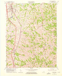
1961 Map of Walton
USGS Topo · Published 1976About this map
Walton and Crittenden anchor the western edge of this 1961 revision, situated along the critical corridors of the Southern and Louisville & Nashville railroads. The map documents a deeply dissected landscape where the borders of Boone, Kenton, Grant, and Pendleton counties converge. Small agricultural communities such as Piner, Fiskburg, and Flingsville are connected by a network of winding roads like High Street and the Grassy Turnpike, which navigate the ridges between the North and Middle Fork of Grassy Creek. Numerous family burial grounds, including Northcutts and the Mann-Roshe Cemeteries, are scattered across the uplands, offering significant data for genealogical research. The presence of Boone Lake and Bullock Pen Lake highlights mid-century water management and recreation within this rural Northern Kentucky terrain.
Find a feature on this map
63 named features on this map. Tap any name to fly to it.
Don’t see what you’re looking for? This feature index may not catch every label — zoom into the map to look around manually.
Map Details
Editions of this 1961 Walton Map
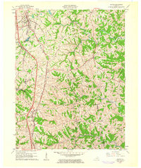
2 editions found
Other maps of this area

1929 · Alexandria
USGS Topo · 1:48,000

1930 · Falmouth
USGS Topo · 1:48,000

1936 · Alexandria
USGS Topo · 1:62,500

1936 · Falmouth
USGS Topo · 1:62,500

1950 · Elliston
USGS Topo · 1:24,000

1950 · Union
USGS Topo · 1:24,000

1950 · Williamstown
USGS Topo · 1:24,000

1950 · Independence
USGS Topo · 1:24,000

1950 · Verona
USGS Topo · 1:24,000

1950 · Walton
USGS Topo · 1:24,000