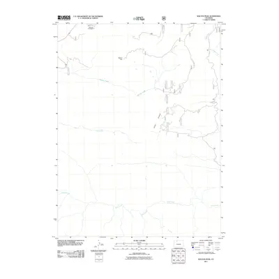
2011 Map of Walton Peak
USGS Topo · Published 2011About this map
Walton Peak serves as the focal point of this high-country landscape in Routt County, situated where the northern extent of the Gore Range meets a complex network of alpine drainages. The area is defined by its water system, with Harrison Creek and Green Creek flowing westward while Sarvis Creek meanders through the southern reaches. This 2011 survey captures the infrastructure of the Routt National Forest, including the Meadows Campground near the northern boundary. Access into the back country is recorded through routes like the Buffalo Park Trl, providing a clear view of the wilderness travel patterns and drainage basins before they leave the quadrangle. The map is particularly useful for understanding the hydrography of the region, tracing the headwaters of Muddy Creek as it winds along the eastern edge near Co-Hwy 19.
Find a feature on this map
9 named features on this map. Tap any name to fly to it.
Don’t see what you’re looking for? This feature index may not catch every label — zoom into the map to look around manually.
Map Details
Editions of this 2011 Walton Peak Map
This is the sole edition of this map. No revisions or reprints were ever made.
Other maps of this area

1954 · Craig
USGS Topo · 1:250,000

1956 · Rabbit Ears Peak
USGS Topo · 1:24,000

1956 · Lake Agnes
USGS Topo · 1:24,000

1956 · Storm Mountain
USGS Topo · 1:24,000

1956 · Walton Peak
USGS Topo · 1:24,000

1956 · Gore Pass
USGS Topo · 1:62,500

1956 · Rabbit Ears Peak
USGS Topo · 1:62,500

1957 · Craig
USGS Topo · 1:250,000

1958 · Craig
USGS Topo · 1:250,000

1960 · Craig
USGS Topo · 1:250,000