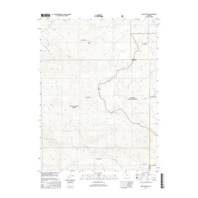
2016 Map of Walton Peak
USGS Topo · Published 2016About this map
Walton Peak serves as a prominent landmark within this high-elevation landscape, where the administrative boundaries of Routt National Forest and Arapaho National Forest converge. The topography is defined by the sharp rise of the Gore Range, carved by numerous drainage systems including Sarvis Cr, Green Cr, and Muddy Cr. This 2016 survey documents a wilderness primarily accessible by non-motorized transport, centered on the winding path of the Routt Divide Trail. The convergence of the Grand and Routt county lines across these peaks highlights the high-altitude surveying challenges of the region. For those studying the geography of the Continental Divide's western slopes, this map provides precise detail on the drainage patterns and trail networks that have facilitated access to these protected lands for decades.
Find a feature on this map
18 named features on this map. Tap any name to fly to it.
Don’t see what you’re looking for? This feature index may not catch every label — zoom into the map to look around manually.
Map Details
Editions of this 2016 Walton Peak Map
This is the sole edition of this map. No revisions or reprints were ever made.
Other maps of this area

1954 · Craig
USGS Topo · 1:250,000

1956 · Rabbit Ears Peak
USGS Topo · 1:24,000

1956 · Lake Agnes
USGS Topo · 1:24,000

1956 · Storm Mountain
USGS Topo · 1:24,000

1956 · Walton Peak
USGS Topo · 1:24,000

1956 · Gore Pass
USGS Topo · 1:62,500

1956 · Rabbit Ears Peak
USGS Topo · 1:62,500

1957 · Craig
USGS Topo · 1:250,000

1958 · Craig
USGS Topo · 1:250,000

1960 · Craig
USGS Topo · 1:250,000