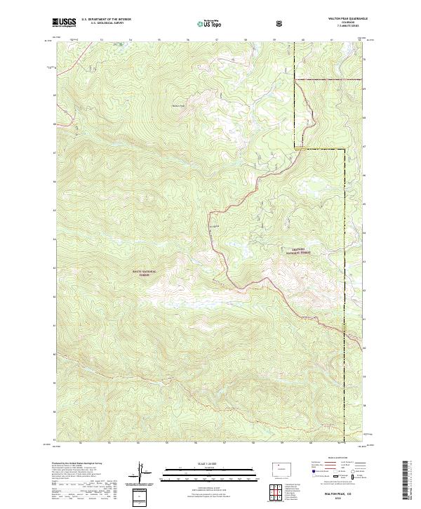
2022 Map of Walton Peak
USGS Topo · Published 2022About this map
Walton Peak rises as the central landmark of this high-elevation landscape, situated at the jurisdictional boundary of the Routt National Forest and the Arapaho National Forest. The map documents a rugged section of the Gore Range, where the continental drainage patterns are defined by the headwaters of Harrison Cr, Green Cr, and Sarvis Cr. Unlike lower-elevation maps, this 2022 survey shows a terrain almost entirely devoid of permanent structures or towns, focusing instead on the network of protected federal lands and the physical boundary shared by Grand and Routt Counties. Long-distance recreational pathways like the Routt Divide Trl and Sarvis Creek Trl trace the ridgelines and valley floors, indicating how the contemporary use of this land has shifted toward conservation and back-country access.
Find a feature on this map
19 named features on this map. Tap any name to fly to it.
Don’t see what you’re looking for? This feature index may not catch every label — zoom into the map to look around manually.
Map Details
Editions of this 2022 Walton Peak Map
This is the sole edition of this map. No revisions or reprints were ever made.
Other maps of this area

1954 · Craig
USGS Topo · 1:250,000

1956 · Rabbit Ears Peak
USGS Topo · 1:24,000

1956 · Lake Agnes
USGS Topo · 1:24,000

1956 · Storm Mountain
USGS Topo · 1:24,000

1956 · Walton Peak
USGS Topo · 1:24,000

1956 · Gore Pass
USGS Topo · 1:62,500

1956 · Rabbit Ears Peak
USGS Topo · 1:62,500

1957 · Craig
USGS Topo · 1:250,000

1958 · Craig
USGS Topo · 1:250,000

1960 · Craig
USGS Topo · 1:250,000