
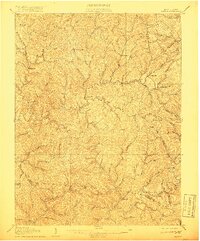
1907 Map of Walton
USGS Topo · Published 1907About this map
The Pocatalico River and its intricate drainage network define the rugged character of Roane County in the first decade of the twentieth century. This area, largely centered around the settlement of Walton, shows a landscape where early industry is closely tied to water power, evidenced by Shamblings Mills and Jones Mill along the river's upper reaches, and Osbornes Mills situated where the Roane Co Kanawha Co boundary line crosses the waterway.
Find a feature on this map
94 named features on this map. Tap any name to fly to it.
Don’t see what you’re looking for? This feature index may not catch every label — zoom into the map to look around manually.
Map Details
Editions of this 1907 Walton Map
3 editions found
Other maps of this area

1897 · Kanawha Falls
USGS Topo · 1:125,000

1899 · Charleston
USGS Topo · 1:125,000

1900 · Kanawha Falls
USGS Topo · 1:125,000

1901 · Kanawha Falls
USGS Topo · 1:125,000

1906 · Kenna
USGS Topo · 1:62,500

1906 · Otter
USGS Topo · 1:62,500

1906 · Walton
USGS Topo · 1:62,500

1907 · Kenna
USGS Topo · 1:62,500

1907 · Otter
USGS Topo · 1:62,500

1907 · Arnoldsburg
USGS Topo · 1:62,500