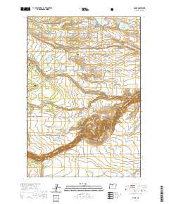
2020 Map of Wamic
USGS Topo · Published 2020About this map
Wamic and Pine Hollow serve as the primary centers of settlement in this part of Wasco County, situated at the eastern margins of the Mount Hood National Forest. The landscape is defined by the transition from forested uplands into the agricultural plateaus of Smock Prairie and Juniper Flat, where an intricate network of irrigation features like Threemile Ditch and Rock Cr Ditch support local agriculture. The dramatic topography of the White Wild and Scenic River canyon cuts through the southern portion of the sheet, providing a sharp contrast to the nearby recreation-focused Pine Hollow Reservoir. For those researching local lineages, the map identifies both the Wamic Cem and the Graveyard Butte Cem near the distinctively named Graveyard Butte.
Find a feature on this map
52 named features on this map. Tap any name to fly to it.
Don’t see what you’re looking for? This feature index may not catch every label — zoom into the map to look around manually.
Map Details
Editions of this 2020 Wamic Map
This is the sole edition of this map. No revisions or reprints were ever made.
Other maps of this area

1930 · Dufur
USGS Topo · 1:125,000

1934 · Dufur
USGS Topo · 1:125,000

1953 · The Dalles
USGS Topo · 1:250,000

1956 · The Dalles
USGS Topo · 1:250,000

1957 · The Dalles
USGS Topo · 1:250,000

1962 · Rock Creek Reservoir
USGS Topo · 1:24,000

1962 · Postage Stamp Butte
USGS Topo · 1:24,000
1962 · Foreman Point
USGS Topo · 1:24,000

1962 · Wamic
USGS Topo · 1:24,000
1962 · Wapinitia
USGS Topo · 1:24,000