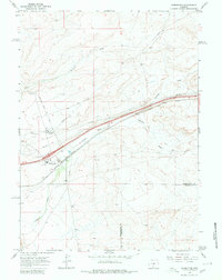
1966 Map of Wamsutter
USGS Topo · Published 1980About this map
Wamsutter serves as the central hub of this mid-1960s survey, illustrating a remote landscape defined by transportation and energy infrastructure. The corridor is dominated by the Union Pacific railroad and the dual passage of Highway 80 and Highway 30, which cut through the high desert terrain. Local connectivity is maintained via the Wamsutter Crooks Gap Road, while the surrounding plains are marked by numerous industrial markers including a Radio Tower, a Pumping Station, and multiple pipelines.
Find a feature on this map
24 named features on this map. Tap any name to fly to it.
Don’t see what you’re looking for? This feature index may not catch every label — zoom into the map to look around manually.
Map Details
Editions of this 1966 Wamsutter Map
3 editions found
Other maps of this area

1954 · Rawlins
USGS Topo · 1:250,000

1954 · Rock Springs
USGS Topo · 1:250,000

1958 · Rawlins
USGS Topo · 1:250,000

1958 · Rock Springs
USGS Topo · 1:250,000

1960 · Lost Creek Butte
USGS Topo · 1:62,500

1962 · Rawlins
USGS Topo · 1:250,000

1962 · Rock Springs
USGS Topo · 1:250,000

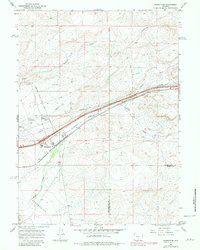
1966 · Wamsutter
USGS Topo · 1:24,000

1966 · Monument Lake
USGS Topo · 1:24,000

1966 · Creston
USGS Topo · 1:24,000