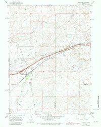
1966 Map of Wamsutter
USGS Topo · Published 1981About this map
Wamsutter stands as the primary hub in this High Desert landscape, situated along the vital transcontinental corridor of the Union Pacific railroad. The settlement's role in transportation and energy infrastructure is evident through the convergence of the Wamsutter Crooks Gap Road, a Pumping Station, and numerous industrial pipelines that traverse the sagebrush-covered terrain. This 1966 topographic study, with revisions through the early 1980s, highlights how human engineering has adapted to the arid environment, featuring water management tools like Threemile Ditch and a small Landing Area for aerial access.
Find a feature on this map
12 named features on this map. Tap any name to fly to it.
Don’t see what you’re looking for? This feature index may not catch every label — zoom into the map to look around manually.
Map Details
Editions of this 1966 Wamsutter Map
3 editions found
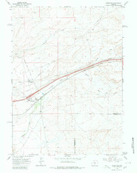
Other maps of this area

1954 · Rawlins
USGS Topo · 1:250,000

1954 · Rock Springs
USGS Topo · 1:250,000

1958 · Rawlins
USGS Topo · 1:250,000

1958 · Rock Springs
USGS Topo · 1:250,000

1960 · Lost Creek Butte
USGS Topo · 1:62,500

1962 · Rawlins
USGS Topo · 1:250,000

1962 · Rock Springs
USGS Topo · 1:250,000

1966 · Wamsutter
USGS Topo · 1:24,000

1966 · Monument Lake
USGS Topo · 1:24,000

1966 · Creston
USGS Topo · 1:24,000