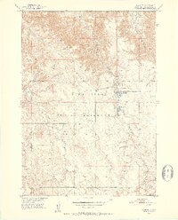
1950 Map of Wanblee
USGS Topo · Published 1952About this map
Wanblee is the primary settlement on this 1950s survey, situated within the vast expanse of the Pine Ridge Indian Reservation. The community is defined by its social and cultural institutions, including Gethsemane Cem and St Ignatius Cem, which provide significant data points for local genealogists. To the southwest, the Eagle Nest Sch stands near the headwaters of Eagle Nest Creek, illustrating the dispersed nature of education and settlement in this portion of South Dakota. The landscape is deeply dissected by a network of drainage systems, with Long Creek and Craven Creek carving through the terrain. This mapping was conducted as part of the Department of the Interior's Missouri River Basin development program, documenting the topographic character of the region shortly after aerial photography was captured in 1948.
Find a feature on this map
8 named features on this map. Tap any name to fly to it.
Don’t see what you’re looking for? This feature index may not catch every label — zoom into the map to look around manually.
Map Details
Editions of this 1950 Wanblee Map
3 editions found
Other maps of this area

1950 · Interior SE
USGS Topo · 1:24,000

1950 · Wanblee
USGS Topo · 1:24,000

1951 · Wanblee NW
USGS Topo · 1:24,000

1951 · School Section Butte
USGS Topo · 1:24,000

1951 · Wanblee NE
USGS Topo · 1:24,000

1955 · Martin
USGS Topo · 1:250,000

1958 · Martin
USGS Topo · 1:250,000

1980 · Kadoka
USGS Topo · 1:100,000

1981 · Broken Leg Dam
USGS Topo · 1:24,000

1981 · Hisle
USGS Topo · 1:25,000