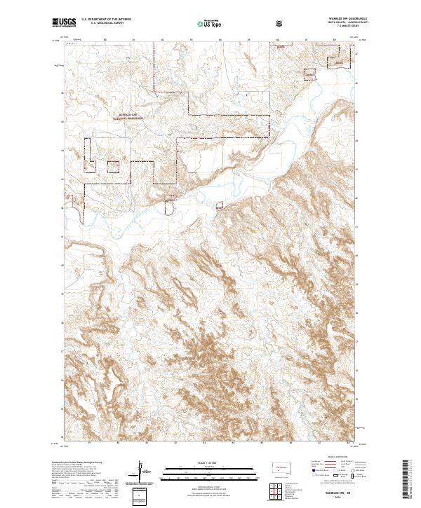
2021 Map of Wanblee NW
USGS Topo · Published 2021About this map
Buffalo Gap National Grassland dominates the northwestern portion of this landscape, where the prairie meets the intricate drainages of the White River. The river creates a significant physical boundary, meandering sharply across the northern sections and fed by seasonal watercourses like Fifteen Cr and Long Cr. This terrain is defined by its drainage patterns, with the southern half of the sheet heavily dissected by the headwaters of Craven Cr. Human presence is marked primarily by rural transit routes such as Co Rd Ch 29 and Weta Rd, which navigate the high ground between the draws and river breaks. The map captures a moment of modern land management within the Jackson County plains, where established national grasslands intersect with local ranch roads.
Find a feature on this map
19 named features on this map. Tap any name to fly to it.
Don’t see what you’re looking for? This feature index may not catch every label — zoom into the map to look around manually.
Map Details
Editions of this 2021 Wanblee NW Map
This is the sole edition of this map. No revisions or reprints were ever made.
Other maps of this area

1950 · Interior SE
USGS Topo · 1:24,000

1950 · Wanblee
USGS Topo · 1:24,000

1950 · Weta
USGS Topo · 1:24,000

1951 · Wanblee NW
USGS Topo · 1:24,000

1951 · School Section Butte
USGS Topo · 1:24,000

1951 · Kadoka
USGS Topo · 1:24,000

1951 · Wanblee NE
USGS Topo · 1:24,000

1955 · Martin
USGS Topo · 1:250,000

1958 · Martin
USGS Topo · 1:250,000
1961 · Cottonwood SE
USGS Topo · 1:24,000