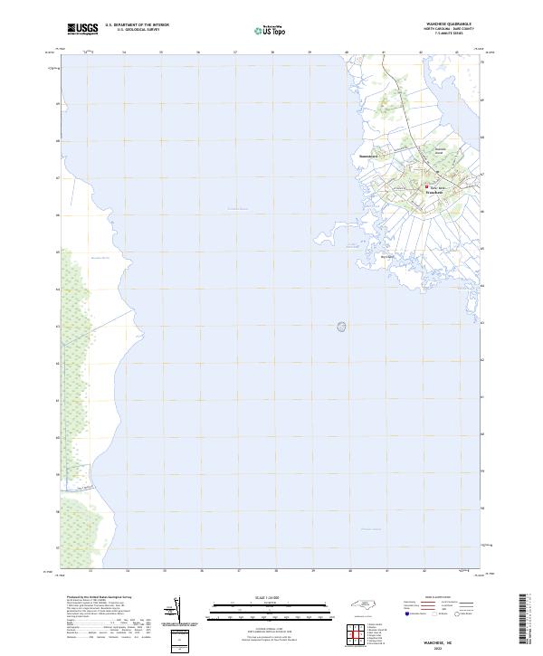
2022 Map of Wanchese
USGS Topo · Published 2022About this map
Roanoke Island anchors this coastal survey, where the southern tip of the island meets the vast waters of the Pamlico Sound. The settlement of Wanchese serves as the primary hub, characterized by a network of local roads such as Old Schoolhouse Rd and Mill Landing Rd that suggest a community deeply tied to the surrounding maritime environment. To the north, Baumtown sits near the shores of Croatan Sound, while the eastern edge of the map touches the iconic Outer Banks.
Find a feature on this map
21 named features on this map. Tap any name to fly to it.
Don’t see what you’re looking for? This feature index may not catch every label — zoom into the map to look around manually.
Map Details
Editions of this 2022 Wanchese Map
This is the sole edition of this map. No revisions or reprints were ever made.
Other maps of this area

1943 · Roanoke Island
USGS Topo · 1:125,000

1953 · Wanchese
USGS Topo · 1:24,000

1953 · Roanoke Island NE
USGS Topo · 1:24,000

1953 · Stumpy Point
USGS Topo · 1:24,000

1953 · Manteo
USGS Topo · 1:24,000

1953 · East Lake SE
USGS Topo · 1:24,000

1953 · Manns Harbor
USGS Topo · 1:24,000

1953 · Engelhard NE
USGS Topo · 1:24,000

1955 · Wanchese
USGS Topo · 1:250,000

1957 · Manteo
USGS Topo · 1:250,000