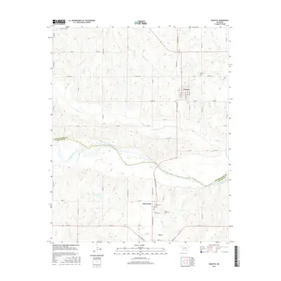
2016 Map of Wanette
USGS Topo · Published 2016About this map
The Canadian River carves a wide, winding path through the borderlands of Pottawatomie and McClain counties, defining the lower portion of this mid-2010s survey. On the northern banks, the community of Wanette sits at a junction of rural routes, anchored by the Wanette Cem and a grid of local streets like Lucas Ave and Vestal Ave. Further south, the map reveals the distinct areas of Johnsonville and Byars, providing a clear look at local burial grounds including the Old Johnsonville Cem and New Johnsonville Cem. The landscape is a mix of agricultural sections and water features such as Hog Cr and the Gallup Ranch Reservoir. Notable transport markers like Railroad Bridge Dr indicate the historical importance of the river crossings to this rural Oklahoma economy.
Find a feature on this map
57 named features on this map. Tap any name to fly to it.
Don’t see what you’re looking for? This feature index may not catch every label — zoom into the map to look around manually.
Map Details
Editions of this 2016 Wanette Map
This is the sole edition of this map. No revisions or reprints were ever made.
Other maps of this area

1896 · Seminole and Prague
USGS Topo · 1:125,000

1898 · Purcell
USGS Topo · 1:125,000

1898 · Pauls Valley
USGS Topo · 1:125,000

1901 · Stonewall
USGS Topo · 1:125,000

1902 · Pauls Valley
USGS Topo · 1:125,000

1907 · Maud
USGS Topo · 1:62,500

1908 · Maud
USGS Topo · 1:62,500

1910 · McComb
USGS Topo · 1:62,500

1954 · Oklahoma City
USGS Topo · 1:250,000

1957 · Ardmore
USGS Topo · 1:250,000