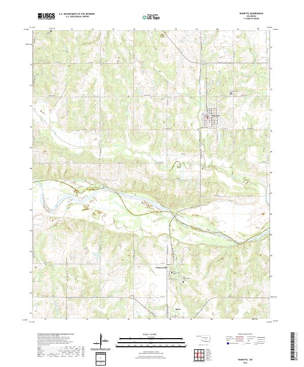
2022 Map of Wanette
USGS Topo · Published 2022About this map
The Wanette townsite sits on the high ground north of the Canadian River, serving as a central hub for the surrounding rural sections of Pottawatomie and McClain counties. This modern survey illustrates a landscape defined by its riparian drainage systems, where Hog Cr and Bond Cr flow toward the river's broad floodplain. For genealogists and local historians, the map is particularly valuable for its documentation of multiple burial sites, including the Wanette Cem and the distinct Old Johnsonville Cem and New Johnsonville Cem located to the south. The terrain transitioning from the river banks to the uplands is marked by significant water features such as the Gallup Ranch Reservoir and the winding course of Canadian Sandy Cr. A dense network of section-line roads, including Rush Rd and Skinner Rd, provides precise orientation for those tracing historic property boundaries and family homesteads.
Find a feature on this map
34 named features on this map. Tap any name to fly to it.
Don’t see what you’re looking for? This feature index may not catch every label — zoom into the map to look around manually.
Map Details
Editions of this 2022 Wanette Map
This is the sole edition of this map. No revisions or reprints were ever made.
Other maps of this area

1896 · Seminole and Prague
USGS Topo · 1:125,000

1898 · Purcell
USGS Topo · 1:125,000

1898 · Pauls Valley
USGS Topo · 1:125,000

1901 · Stonewall
USGS Topo · 1:125,000

1902 · Pauls Valley
USGS Topo · 1:125,000

1907 · Maud
USGS Topo · 1:62,500

1908 · Maud
USGS Topo · 1:62,500

1910 · McComb
USGS Topo · 1:62,500

1954 · Oklahoma City
USGS Topo · 1:250,000

1957 · Ardmore
USGS Topo · 1:250,000