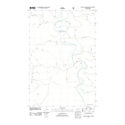
2011 Map of Wannagan Creek East
USGS Topo · Published 2011About this map
Wolf Ranch and McLeod Ranch occupy the northern reaches of this Billings County landscape, where the meandering Little Missouri River carves through the terrain. The map reveals a pattern of isolated ranching outposts established near reliable water sources like Wannagan Creek and Franks Creek. Notable topographic features such as Grassy Butte in the northwest and Pikes Peak near the river highlight the distinct elevation changes of the Little Missouri Badlands. These landforms, along with named draws like Hay Draw and Wolf Draw, dictate the path of local routes such as E River Rd and Wannagan Creek Rd. The distribution of family-named sites, including W Myers Ranch and Mosser Ranch, provides a detailed look at the rural settlement and land use within this portion of the Badlands during the early 21st century.
Find a feature on this map
24 named features on this map. Tap any name to fly to it.
Don’t see what you’re looking for? This feature index may not catch every label — zoom into the map to look around manually.
Map Details
Editions of this 2011 Wannagan Creek East Map
This is the sole edition of this map. No revisions or reprints were ever made.
Other maps of this area

1953 · Dickinson
USGS Topo · 1:250,000

1953 · Watford City
USGS Topo · 1:250,000

1957 · Dickinson
USGS Topo · 1:250,000

1957 · Watford City
USGS Topo · 1:250,000

1962 · Fryburg NW
USGS Topo · 1:24,000

1963 · Gorham SW
USGS Topo · 1:24,000

1963 · Gorham NW
USGS Topo · 1:24,000

1967 · Watford City
USGS Topo · 1:250,000

1970 · Wannagan Creek East
USGS Topo · 1:24,000

1970 · Roosevelt Creek East
USGS Topo · 1:24,000