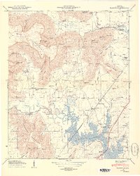
1950 Map of Wannville
USGS Topo · Published 1950About this map
The Guntersville Reservoir dominates this 1950 Jackson County landscape, its backwaters reaching deep into the valleys of Mud Creek and Big Coon Creek. This era reveals a transition from traditional upland agriculture to a lake-centered economy, evidenced by the Mud Creek Boat Dock sitting adjacent to old family-named landmarks. The map is a significant resource for genealogists, documenting numerous local burial grounds such as Pauper Cem, Longacre Cem, and Stogsdill Cem.
Find a feature on this map
57 named features on this map. Tap any name to fly to it.
Don’t see what you’re looking for? This feature index may not catch every label — zoom into the map to look around manually.
Map Details
Editions of this 1950 Wannville Map
2 editions found
Other maps of this area

1886 · Stevenson
USGS Topo · 1:125,000

1888 · Scottsboro
USGS Topo · 1:125,000

1892 · Scottsboro
USGS Topo · 1:125,000

1892 · Stevenson
USGS Topo · 1:125,000

1895 · Stevenson
USGS Topo · 1:125,000

1936 · Scottsboro
USGS Topo · 1:24,000

1936 · Wannville
USGS Topo · 1:24,000

1936 · Mud Creek
USGS Topo · 1:24,000

1936 · Hytop
USGS Topo · 1:24,000

1936 · Hollywood
USGS Topo · 1:24,000