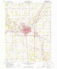
1961 Map of Wapakoneta
USGS Topo · Published 1974About this map
Wapakoneta sits at a geographic crossroads in Auglaize County, where the industrial and civic activity of the mid-20th century is clearly defined by the Baltimore and Ohio and Penn Central railroads. The town landscape includes institutional landmarks like the Courthouse, Library, and County Fairground, while the surrounding rural townships of Duchouquet, Moulton, and Pusheta are marked by a high density of country burial grounds, including Greenlawn Cemetery and St Joseph Cem. The southern reach of the map is defined by the Old Indian Treaty Boundary, a significant historical line cutting across the agricultural terrain. Waterways such as the Auglaize River and Pusheta Creek snake through the landscape, alongside smaller settlements like Fryburg and Glynwood. This survey, updated with purple revisions from the early 1970s, captures the growth of the local highway system and suburban edges during a period of infrastructure expansion.
Find a feature on this map
70 named features on this map. Tap any name to fly to it.
Don’t see what you’re looking for? This feature index may not catch every label — zoom into the map to look around manually.
Map Details
Editions of this 1961 Wapakoneta Map
4 editions found
Other maps of this area

1906 · Lima
USGS Topo · 1:62,500

1909 · Loramie
USGS Topo · 1:62,500

1911 · Loramie
USGS Topo · 1:62,500

1911 · Spencerville
USGS Topo · 1:62,500

1913 · Sidney
USGS Topo · 1:62,500

1944 · Sidney
USGS Topo · 1:62,500

1944 · Loramie
USGS Topo · 1:62,500

1944 · Spencerville
USGS Topo · 1:62,500

1953 · Muncie
USGS Topo · 1:250,000

1956 · Muncie
USGS Topo · 1:250,000