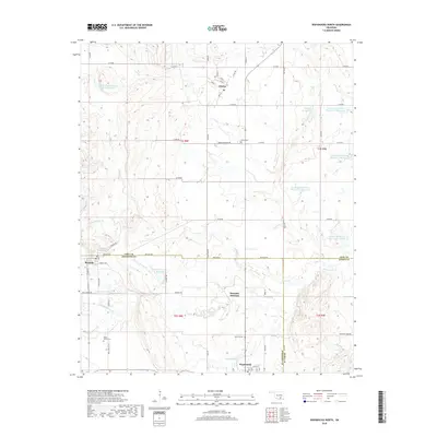
2018 Map of Wapanucka North
USGS Topo · Published 2018About this map
Clarita and Bromide serve as the primary hubs in this rural landscape where Coal, Johnston, and Atoka Counties converge. The region is defined by its sophisticated water management system, featuring a series of numbered reservoirs including Leader Middle Clear Boggy Cr 6 Reservoir and several sites along Delaware Creek. These man-made features are interwoven with natural landmarks like Sulphur Springs and Wide Springs, suggesting a long history of water resource utilization in this corner of Oklahoma.
Find a feature on this map
71 named features on this map. Tap any name to fly to it.
Don’t see what you’re looking for? This feature index may not catch every label — zoom into the map to look around manually.
Map Details
Editions of this 2018 Wapanucka North Map
This is the sole edition of this map. No revisions or reprints were ever made.
Other maps of this area

1896 · Coalgate
USGS Topo · 1:125,000

1899 · Coalgate
USGS Topo · 1:125,000

1899 · Atoka
USGS Topo · 1:125,000

1900 · Atoka
USGS Topo · 1:125,000

1900 · Coalgate
USGS Topo · 1:125,000

1901 · Stonewall
USGS Topo · 1:125,000

1901 · Tishomingo
USGS Topo · 1:125,000

1957 · Centrahoma
USGS Topo · 1:24,000

1957 · Ardmore
USGS Topo · 1:250,000

1963 · Ardmore
USGS Topo · 1:250,000