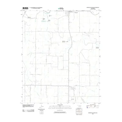
2009 Map of Wapanucka South
USGS Topo · Published 2009About this map
Wapanucka anchors the northern edge of this Southern Oklahoma landscape, which is defined by a dense network of water management and rural family routes in the late 2000s. The terrain is marked by multiple flood control structures along the tributaries of Delaware Creek, including Lake Wapanucka Dam and the Lake Ream Dam. These reservoirs and dams sit among a grid of roads named for local families and landmarks, such as Luffy Chapel Rd, Dark Corner Rd, and Cat Cave Rd.
Find a feature on this map
45 named features on this map. Tap any name to fly to it.
Don’t see what you’re looking for? This feature index may not catch every label — zoom into the map to look around manually.
Map Details
Editions of this 2009 Wapanucka South Map
This is the sole edition of this map. No revisions or reprints were ever made.
Other maps of this area

1899 · Atoka
USGS Topo · 1:125,000

1900 · Atoka
USGS Topo · 1:125,000

1901 · Tishomingo
USGS Topo · 1:125,000

1957 · Ardmore
USGS Topo · 1:250,000

1963 · Ardmore
USGS Topo · 1:250,000

1967 · Connerville SE
USGS Topo · 1:24,000
1967 · Connerville NE
USGS Topo · 1:24,000
1967 · Milburn
USGS Topo · 1:24,000
1968 · Wapanucka South
USGS Topo · 1:24,000

1968 · Caddo NW
USGS Topo · 1:24,000