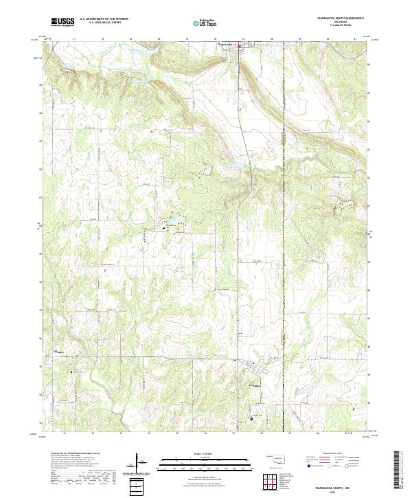
2022 Map of Wapanucka South
USGS Topo · Published 2022About this map
Wapanucka serves as the northern anchor for this rural Johnston County landscape, situated near a series of managed waterways including the Delaware Cr Site 7 Reservoir and Wapanucka Lake. The terrain is defined by the winding paths of Sandy Creek and Birch Cr, which navigate a grid of country roads and section lines. To the south, the settlements of Fillmore and Coleman provide local hubs for the surrounding agricultural and ranching community.
Find a feature on this map
75 named features on this map. Tap any name to fly to it.
Don’t see what you’re looking for? This feature index may not catch every label — zoom into the map to look around manually.
Map Details
Editions of this 2022 Wapanucka South Map
This is the sole edition of this map. No revisions or reprints were ever made.
Other maps of this area

1899 · Atoka
USGS Topo · 1:125,000

1900 · Atoka
USGS Topo · 1:125,000

1901 · Tishomingo
USGS Topo · 1:125,000

1957 · Ardmore
USGS Topo · 1:250,000

1963 · Ardmore
USGS Topo · 1:250,000

1967 · Connerville SE
USGS Topo · 1:24,000
1967 · Connerville NE
USGS Topo · 1:24,000
1967 · Milburn
USGS Topo · 1:24,000
1968 · Wapanucka South
USGS Topo · 1:24,000

1968 · Caddo NW
USGS Topo · 1:24,000