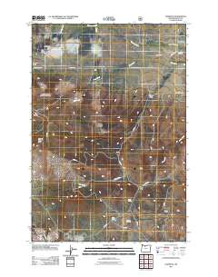
2011 Map of Wapinitia
USGS Topo · Published 2011About this map
Pine Grove and Wapinitia serve as the primary focal points of this high plateau in Wasco County, where the landscape is defined by a network of drainage gulches and seasonal creeks. The terrain transitions from the volcanic prominence of Bald Peter Butte toward the canyon-carved paths of Wapinitia Creek and Rice Creek. Rural infrastructure is grounded by long-standing landmarks such as the Wapinitia Cemetery and Red Lake Cemetery, which provide essential touchpoints for genealogical research in this sparsely populated region. Industrial activity is represented by the Rainbow Quarry, while the southern reaches of the map highlight water sources like Nena Spring and Red Lake. This document illustrates a landscape managed through a complex system of Bureau of Indian Affairs and Forest Service routes, including BIA 3 Rd and S 421 Rd, reflecting the intersection of public lands and traditional ranching or agricultural tracts.
Find a feature on this map
31 named features on this map. Tap any name to fly to it.
Don’t see what you’re looking for? This feature index may not catch every label — zoom into the map to look around manually.
Map Details
Editions of this 2011 Wapinitia Map
This is the sole edition of this map. No revisions or reprints were ever made.
Other maps of this area

1928 · Madras
USGS Topo · 1:125,000

1930 · Dufur
USGS Topo · 1:125,000

1931 · Madras
USGS Topo · 1:125,000

1934 · Dufur
USGS Topo · 1:125,000

1953 · The Dalles
USGS Topo · 1:250,000

1955 · Bend
USGS Topo · 1:250,000

1956 · The Dalles
USGS Topo · 1:250,000

1957 · Bend
USGS Topo · 1:250,000

1957 · The Dalles
USGS Topo · 1:250,000

1958 · Bend
USGS Topo · 1:250,000