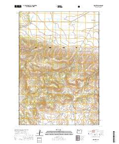
2020 Map of Wapinitia
USGS Topo · Published 2020About this map
Pine Grove and Wapinitia sit atop the high plateaus of Wasco County, where the agricultural landscape of Juniper Flat meets the rising timber of the Mount Hood National Forest. This 2020 survey illustrates a region defined by its water management and high-desert terrain, with Roberts Reservoirs and Nena Spring supporting the local ecosystem alongside drainages like Wapinitia Cr and Rice Cr. The southern portion of the map is dominated by the prominent elevations of the Laughlin Hills and Bald Peter Butte, providing a stark contrast to the flatter ranching lands to the north. Genealogists will find the locations of Wapinitia Cem and Red Lake Cem particularly useful, while the network of forest service roads, such as S-421 Rd and S-410 Rd, reveals the infrastructure used for modern land management and recreation near Red Lake.
Find a feature on this map
43 named features on this map. Tap any name to fly to it.
Don’t see what you’re looking for? This feature index may not catch every label — zoom into the map to look around manually.
Map Details
Editions of this 2020 Wapinitia Map
This is the sole edition of this map. No revisions or reprints were ever made.
Other maps of this area

1928 · Madras
USGS Topo · 1:125,000

1930 · Dufur
USGS Topo · 1:125,000

1931 · Madras
USGS Topo · 1:125,000

1934 · Dufur
USGS Topo · 1:125,000

1953 · The Dalles
USGS Topo · 1:250,000

1955 · Bend
USGS Topo · 1:250,000

1956 · The Dalles
USGS Topo · 1:250,000

1957 · Bend
USGS Topo · 1:250,000

1957 · The Dalles
USGS Topo · 1:250,000

1958 · Bend
USGS Topo · 1:250,000