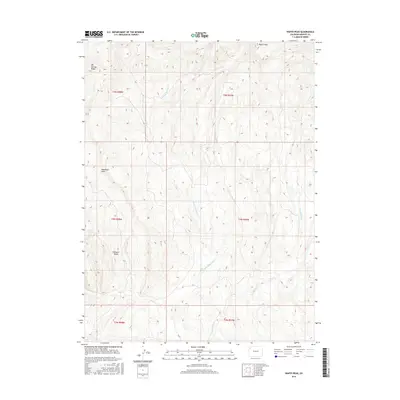
2016 Map of Wapiti Peak
USGS Topo · Published 2016About this map
Wapiti Peak serves as a prominent high point in this corner of Colorado, overlooking a landscape defined by sharp elevation changes and seasonal watercourses. The 2016 survey shows the intricate drainage patterns of Crooked Wash and the N Fork Sagebrush Cr, which carve through the arid terrain between established high ground. This region is marked by significant topographical landmarks like Elk Springs Ridge and Pinyon Ridge, which delineate the varied relief of the Northwestern Colorado plateau. The lack of major modern infrastructure on this sheet highlights its character as open land, dominated by natural features such as Sagebrush Draw. Public Land Survey System grids, including t5n r97w and t4n r98w, provide a framework for the vast acreage, tracing the boundaries of sections that remain largely undeveloped.
Find a feature on this map
13 named features on this map. Tap any name to fly to it.
Don’t see what you’re looking for? This feature index may not catch every label — zoom into the map to look around manually.
Map Details
Editions of this 2016 Wapiti Peak Map
This is the sole edition of this map. No revisions or reprints were ever made.
Other maps of this area

1907 · White River
USGS Topo · 1:125,000

1910 · White River
USGS Topo · 1:125,000

1954 · Vernal
USGS Topo · 1:250,000

1958 · Vernal
USGS Topo · 1:250,000

1958 · Citadel Plateau
USGS Topo · 1:62,500

1960 · Vernal
USGS Topo · 1:250,000

1960 · Elk Springs
USGS Topo · 1:62,500
1966 · Smizer Gulch
USGS Topo · 1:24,000
1966 · Rough Gulch
USGS Topo · 1:24,000
1966 · Indian Valley
USGS Topo · 1:24,000