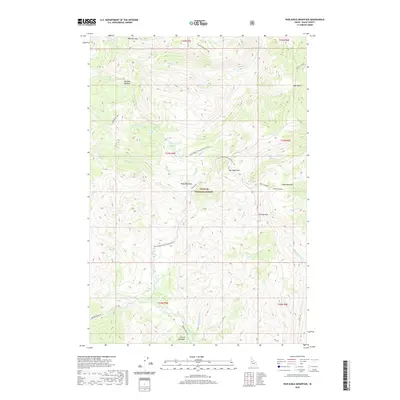
2020 Map of War Eagle Mountain
USGS Topo · Published 2020About this map
War Eagle Mtn and Marshall Mtn anchor this high-altitude landscape within the Payette National Forest. The map reveals a complex network of glacial and alpine drainage systems, with California Lake tucked into a high basin and numerous meadows such as Kelly Meadows and Floyd Meadows providing breaks in the timbered slopes. The presence of named clearings like Rye Patch and significant peaks such as Chimney Rock suggests a landscape shaped by both geological time and early forest management history.
Find a feature on this map
37 named features on this map. Tap any name to fly to it.
Don’t see what you’re looking for? This feature index may not catch every label — zoom into the map to look around manually.
Map Details
Editions of this 2020 War Eagle Mountain Map
This is the sole edition of this map. No revisions or reprints were ever made.
Other maps of this area

1956 · Burgdorf
USGS Topo · 1:62,500

1956 · Warren
USGS Topo · 1:62,500

1956 · Elk City
USGS Topo · 1:250,000

1960 · Elk City
USGS Topo · 1:250,000

1969 · Loon Lake
USGS Topo · 1:24,000

1969 · Pony Meadows
USGS Topo · 1:24,000
1969 · Victor Peak
USGS Topo · 1:24,000

1981 · Warren
USGS Topo · 1:100,000
1989 · Johnson Butte
USGS Topo · 1:24,000
1989 · Warren
USGS Topo · 1:24,000