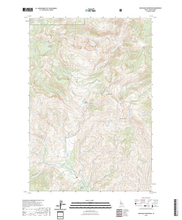
2024 Map of War Eagle Mountain
USGS Topo · Published 2024About this map
Payette National Forest dominates this high-altitude landscape, where the Secesh River winds through the southern terrain near Secesh Meadows. This modern survey reveals a complex network of backcountry access points, including the Warren Wagon Rd and various forest development routes that provide passage through steep mountain topography. The prominence of War Eagle Mtn and Chimney Rock serves as a geographic anchor for the region, while numerous seasonal clearings like Marshall Meadow and Kelly Meadows suggest the historic use of these basins for grazing or wilderness outposts. High-country drainage patterns are well-defined by the paths of California Creek and Grouse Creek, illustrating the remote nature of the t23n r5e and t23n r6e townships in Idaho County.
Find a feature on this map
37 named features on this map. Tap any name to fly to it.
Don’t see what you’re looking for? This feature index may not catch every label — zoom into the map to look around manually.
Map Details
Editions of this 2024 War Eagle Mountain Map
This is the sole edition of this map. No revisions or reprints were ever made.
Other maps of this area

1956 · Burgdorf
USGS Topo · 1:62,500

1956 · Warren
USGS Topo · 1:62,500

1956 · Elk City
USGS Topo · 1:250,000

1960 · Elk City
USGS Topo · 1:250,000

1969 · Loon Lake
USGS Topo · 1:24,000

1969 · Pony Meadows
USGS Topo · 1:24,000
1969 · Victor Peak
USGS Topo · 1:24,000

1981 · Warren
USGS Topo · 1:100,000
1989 · Johnson Butte
USGS Topo · 1:24,000
1989 · Warren
USGS Topo · 1:24,000