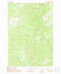
1989 Map of War Eagle Mountain
USGS Topo · Published 1990About this map
War Eagle Mountain and Marshall Mountain anchor this high-altitude landscape within the Payette National Forest. The map documents a rugged interior shaped by historical extraction, featuring the Humboldt Mine and several Open Pit Mines concentrated near Wallis Cabin. A complex network of drainage basins defines the terrain, with California Creek and Union Creek flowing through steep canyons while the Secesh River winds through the southern meadows. The inclusion of the War Eagle Lookout suggests the importance of fire management and observation across these ridges in the late twentieth century. Local history is preserved in named landmarks like the Rye Patch, Kelly Meadows, and Floyd Meadows, marking clearings and grazing spots that provided essential breaks in the dense forest cover. This survey captures a moment of active resource management and mining activity in a high mountain environment.
Find a feature on this map
28 named features on this map. Tap any name to fly to it.
Don’t see what you’re looking for? This feature index may not catch every label — zoom into the map to look around manually.
Map Details
Editions of this 1989 War Eagle Mountain Map
This is the sole edition of this map. No revisions or reprints were ever made.
Other maps of this area

1956 · Burgdorf
USGS Topo · 1:62,500

1956 · Warren
USGS Topo · 1:62,500

1956 · Elk City
USGS Topo · 1:250,000

1960 · Elk City
USGS Topo · 1:250,000

1969 · Loon Lake
USGS Topo · 1:24,000

1969 · Pony Meadows
USGS Topo · 1:24,000
1969 · Victor Peak
USGS Topo · 1:24,000

1981 · Warren
USGS Topo · 1:100,000
1989 · Johnson Butte
USGS Topo · 1:24,000
1989 · Warren
USGS Topo · 1:24,000