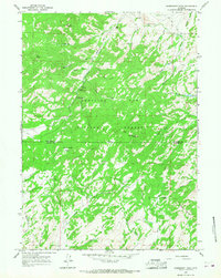
1964 Map of Warbonnet Peak
USGS Topo · Published 1968About this map
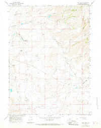
Warbonnet Peak and Squaw Mountain dominate this high-altitude landscape along the border of Converse Co and Albany Co. Most of the area is contained within the Medicine Bow National Forest, where a network of watercourses including La Prele Creek, Bear Creek, and French Creek carve through the terrain. The map records a working landscape of ranching and early resource extraction, evidenced by the H-V Ranch in the north and the Old Copper King Mine near Cacona Creek.
Find a feature on this map
41 named features on this map. Tap any name to fly to it.
Don’t see what you’re looking for? This feature index may not catch every label — zoom into the map to look around manually.
Map Details
Editions of this 1964 Warbonnet Peak Map
2 editions found
Other maps of this area

1954 · Torrington
USGS Topo · 1:250,000

1958 · Torrington
USGS Topo · 1:250,000

1964 · Toltec
USGS Topo · 1:24,000

1964 · Buck Peak
USGS Topo · 1:24,000

1964 · School Section Mountain
USGS Topo · 1:24,000

1964 · Buffalo Peak
USGS Topo · 1:24,000
1964 · Blue Nose Creek
USGS Topo · 1:24,000
1964 · Rock Creek
USGS Topo · 1:24,000
1964 · Pass Creek
USGS Topo · 1:24,000

1964 · Marshall
USGS Topo · 1:24,000