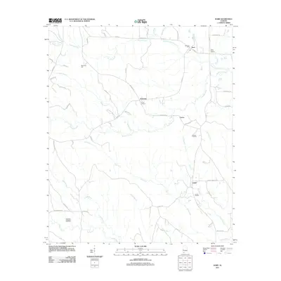
2011 Map of Ward
USGS Topo · Published 2011About this map
Ward serves as the primary hub in this corner of Sumter County, anchored by the Ward Post Office near the intersection of CO Hwy-16 and CO Hwy-9. The landscape is defined by an intricate network of waterways including Kinterbish Creek and its tributary, Little Kinterbish Creek, which drain the timberlands of west Alabama. Small communities like Kinterbish, Charles, and Halsell are scattered across the quadrangle, each marked by historical family and community landmarks.
Find a feature on this map
65 named features on this map. Tap any name to fly to it.
Don’t see what you’re looking for? This feature index may not catch every label — zoom into the map to look around manually.
Map Details
Editions of this 2011 Ward Map
This is the sole edition of this map. No revisions or reprints were ever made.
Other maps of this area

1953 · Meridian
USGS Topo · 1:250,000

1957 · Meridian
USGS Topo · 1:250,000

1965 · Meridian
USGS Topo · 1:250,000

1971 · Gaston
USGS Topo · 1:24,000

1971 · Bellamy
USGS Topo · 1:24,000

1974 · Yantley
USGS Topo · 1:24,000

1974 · Ward
USGS Topo · 1:24,000

1974 · Lisman
USGS Topo · 1:24,000
1974 · York
USGS Topo · 1:24,000
1974 · Kewanee
USGS Topo · 1:24,000