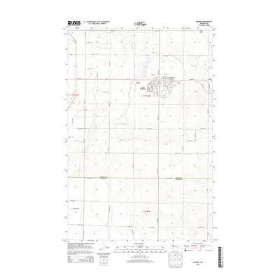
2014 Map of Warden
USGS Topo · Published 2014About this map
Warden and its western neighbor West Warden serve as the primary hubs in this agricultural and transportation corridor in eastern Washington. The street grid of the main town is clearly defined by routes like Evan Hall St and Basin St, showing the compact residential and commercial core. To the north and east, the landscape is carved by Lind Coulee, a significant topographic feature that dictates the path of local travel and land use. The presence of Warden Airport west of the town center highlights the regional importance of local aviation for both travel and crop management in this fertile section of Grant County. Running south, the boundary between Grant Co and Adams Co passes through a grid of section roads, including W Providence Rd, which reflects the systematic land division characteristic of the Columbia Basin Project's influence on the local geography.
Find a feature on this map
39 named features on this map. Tap any name to fly to it.
Don’t see what you’re looking for? This feature index may not catch every label — zoom into the map to look around manually.
Map Details
Editions of this 2014 Warden Map
This is the sole edition of this map. No revisions or reprints were ever made.
Other maps of this area

1916 · Connell
USGS Topo · 1:125,000

1918 · Connell
USGS Topo · 1:125,000

1923 · Wheeler
USGS Topo · 1:62,500

1924 · Othello
USGS Topo · 1:62,500

1925 · Wheeler
USGS Topo · 1:62,500

1925 · Schrag
USGS Topo · 1:62,500

1953 · Walla Walla
USGS Topo · 1:250,000

1953 · Ritzville
USGS Topo · 1:250,000

1954 · Bruce
USGS Topo · 1:24,000

1954 · Warden
USGS Topo · 1:24,000