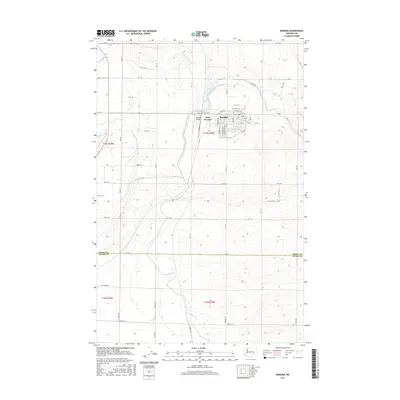
2017 Map of Warden
USGS Topo · Published 2017About this map
The agricultural and transit hub of Warden is documented here as it appeared in 2017, situated at the boundary between Grant and Adams counties. The town's grid is defined by its connection to the regional transport network, including Railroad Ave, Evan Hall St, and Weir Way. On the western edge, the community expands toward West Warden and the Warden Airport, which serves this productive section of the Columbia Basin. The surrounding landscape is dominated by a systematic grid of section roads, such as W Herman Rd and W Rankin Rd, and irrigation infrastructure represented by Canal Rd. This survey captures the town's role as a vital processing and shipping point for the vast agricultural operations of central Washington, illustrating the precise alignment of rural township lines and local landmarks that define the region's geography.
Find a feature on this map
29 named features on this map. Tap any name to fly to it.
Don’t see what you’re looking for? This feature index may not catch every label — zoom into the map to look around manually.
Map Details
Editions of this 2017 Warden Map
This is the sole edition of this map. No revisions or reprints were ever made.
Other maps of this area

1916 · Connell
USGS Topo · 1:125,000

1918 · Connell
USGS Topo · 1:125,000

1923 · Wheeler
USGS Topo · 1:62,500

1924 · Othello
USGS Topo · 1:62,500

1925 · Wheeler
USGS Topo · 1:62,500

1925 · Schrag
USGS Topo · 1:62,500

1953 · Walla Walla
USGS Topo · 1:250,000

1953 · Ritzville
USGS Topo · 1:250,000

1954 · Bruce
USGS Topo · 1:24,000

1954 · Warden
USGS Topo · 1:24,000