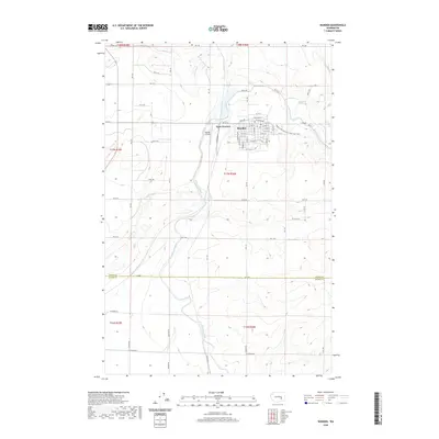
2020 Map of Warden
USGS Topo · Published 2020About this map
Warden and its western neighbor West Warden anchor this 2020 landscape, situated in a region defined by agricultural irrigation and modern transport corridors. The area is dominated by the East Low Canal, a massive engineering project that snakes through the terrain to support the arid plateau's farming economy. The map traces the intersection of local infrastructure and public recreation, specifically where the Palouse To Cascades State Park Trail follows an old rail alignment through the town center, crossing streets like Railroad Ave and Jackson Ave. The southern portion of the quadrangle marks the boundary between Grant and Adams Counties, showing a high-resolution view of contemporary land divisions and the network of section-line roads such as Rd 10 SE. Small-scale aviation is represented by the Warden Airport, located just west of the primary settlement.
Find a feature on this map
49 named features on this map. Tap any name to fly to it.
Don’t see what you’re looking for? This feature index may not catch every label — zoom into the map to look around manually.
Map Details
Editions of this 2020 Warden Map
This is the sole edition of this map. No revisions or reprints were ever made.
Other maps of this area

1916 · Connell
USGS Topo · 1:125,000

1918 · Connell
USGS Topo · 1:125,000

1923 · Wheeler
USGS Topo · 1:62,500

1924 · Othello
USGS Topo · 1:62,500

1925 · Wheeler
USGS Topo · 1:62,500

1925 · Schrag
USGS Topo · 1:62,500

1953 · Walla Walla
USGS Topo · 1:250,000

1953 · Ritzville
USGS Topo · 1:250,000

1954 · Bruce
USGS Topo · 1:24,000

1954 · Warden
USGS Topo · 1:24,000