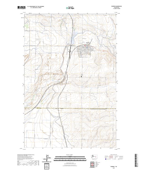
2023 Map of Warden
USGS Topo · Published 2023About this map
Warden serves as the primary hub in this central Washington landscape, where the engineered path of the East Low Canal cuts through the desert terrain. The map documents the town's expansion toward West Warden and the influence of water management on the surrounding agricultural grid, defined by routes like Canal Rd and Rd 10 SE. The deep incision of Lind Coulee provides a natural contrast to the straight-line irrigation works that dominate the region's geography. Historically significant routes are also preserved here, most notably the Palouse To Cascades State Park Trl, which follows a former rail corridor across the county line between Grant Co and Adams Co. Researchers will find local landmarks including Warden Airport and the Sunset Memorial Gardens cemetery, providing a detailed look at the infrastructure supporting this Columbia Basin community.
Find a feature on this map
43 named features on this map. Tap any name to fly to it.
Don’t see what you’re looking for? This feature index may not catch every label — zoom into the map to look around manually.
Map Details
Editions of this 2023 Warden Map
This is the sole edition of this map. No revisions or reprints were ever made.
Other maps of this area

1916 · Connell
USGS Topo · 1:125,000

1918 · Connell
USGS Topo · 1:125,000

1923 · Wheeler
USGS Topo · 1:62,500

1924 · Othello
USGS Topo · 1:62,500

1925 · Wheeler
USGS Topo · 1:62,500

1925 · Schrag
USGS Topo · 1:62,500

1953 · Walla Walla
USGS Topo · 1:250,000

1953 · Ritzville
USGS Topo · 1:250,000

1954 · Bruce
USGS Topo · 1:24,000

1954 · Warden
USGS Topo · 1:24,000