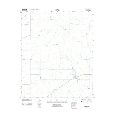
2012 Map of Wardville
USGS Topo · Published 2012About this map
Wardville serves as the primary hub in this rural Atoka County landscape, situated where Main St meets the surrounding country roads. The area is defined by a dense network of creek drainages, including the prominent Salt Cr and Keel Cr, which meander through the prairie. A historical boundary, the Indian Bnd, cuts through the western portion of the territory, reflecting the complex land divisions of this part of Oklahoma. Genealogy researchers will find several well-preserved family and community burial sites, such as King Cem, Lone Star Cem, and the Wardville Cem. The unique presence of the Salt Prairie in the northwest suggests a distinct ecological and geological feature that shaped early settlement patterns, while roads like Harper Valley Rd and Lonestar Church Rd connect the scattered homesteads of this quiet region.
Find a feature on this map
37 named features on this map. Tap any name to fly to it.
Don’t see what you’re looking for? This feature index may not catch every label — zoom into the map to look around manually.
Map Details
Editions of this 2012 Wardville Map
This is the sole edition of this map. No revisions or reprints were ever made.
Other maps of this area

1896 · Coalgate
USGS Topo · 1:125,000

1898 · McAlester
USGS Topo · 1:125,000

1899 · Coalgate
USGS Topo · 1:125,000

1900 · Coalgate
USGS Topo · 1:125,000

1909 · Mc Alester
USGS Topo · 1:125,000

1950 · Mcalester
USGS Topo · 1:250,000

1957 · Coalgate
USGS Topo · 1:24,000

1957 · Coalgate SE
USGS Topo · 1:24,000

1957 · Limestone Gap
USGS Topo · 1:24,000

1957 · Ardmore
USGS Topo · 1:250,000