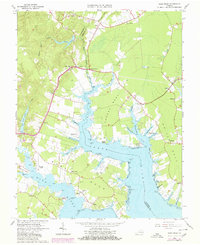
1965 Map of Ware Neck
USGS Topo · Published 1980About this map
The coastal peninsulae of Chapel Neck and White Neck dominate this mid-century survey of the Virginia Tidewater. Situated where the North River and Ware River meet Mobjack Bay, the landscape is defined by its maritime infrastructure and small rural crossroads. Evidence of the region’s river-based economy is found at Auburn Wharf and the Baileys Wharf Beacon, while the interior is dotted with historical community centers like James Store and Fort Nonsense.
Find a feature on this map
65 named features on this map. Tap any name to fly to it.
Don’t see what you’re looking for? This feature index may not catch every label — zoom into the map to look around manually.
Map Details
Editions of this 1965 Ware Neck Map
4 editions found
Other maps of this area

1906 · Williamsburg
USGS Topo · 1:62,500

1916 · Kilmarnock
USGS Topo · 1:48,000

1916 · Mathews
USGS Topo · 1:62,500

1917 · Urbanna
USGS Topo · 1:62,500

1917 · Kilmarnock
USGS Topo · 1:62,500

1917 · Mathews
USGS Topo · 1:62,500

1942 · Kilmarnock
USGS Topo · 1:62,500

1943 · Richmond
USGS Topo · 1:250,000

1948 · Ware Neck
USGS Topo · 1:24,000

1948 · Achilles
USGS Topo · 1:24,000