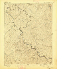
1891 Map of Warfield
USGS Topo · Published 1895About this map
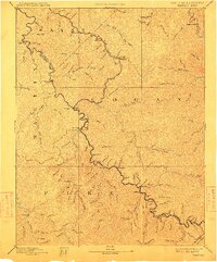
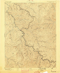
Tug Fork of Big Sandy River carves the vital border between West Virginia and Kentucky in this survey from the mid-1880s. The region is defined by its deep river valleys and the recent arrival of the Norfolk and Western R.R. (Ohio Division), which follows the winding watercourse through coal-rich borderlands. Key transportation hubs like Warfield and Williamson are depicted in their early years of development, alongside smaller riverside stops including Matewan, Naugatuck, and Delorme. This map captures the industrial transition of the Central Appalachian coalfields before the turn of the century. Away from the main river, a dense network of mountain streams such as Pigeon Creek and Marrowbone Creek dictate the settlement patterns of Logan, Wayne, and Martin counties. The intricate topography reveals the logistical challenges of early rail construction through the Dingess tunnel area and the rugged timber and mining country of the era.
Find a feature on this map
105 named features on this map. Tap any name to fly to it.
Don’t see what you’re looking for? This feature index may not catch every label — zoom into the map to look around manually.
Map Details
Editions of this 1891 Warfield Map
7 editions found
Other maps of this area

1886 · Prestonsburg
USGS Topo · 1:125,000

1886 · Grundy
USGS Topo · 1:125,000

1887 · Warfield
USGS Topo · 1:125,000

1890 · Whitesburg
USGS Topo · 1:125,000

1890 · Grundy
USGS Topo · 1:125,000

1891 · Tazewell
USGS Topo · 1:125,000

1891 · Oceana
USGS Topo · 1:125,000

1891 · Warfield
USGS Topo · 1:125,000

1892 · Grundy
USGS Topo · 1:125,000

1892 · Whitesburg
USGS Topo · 1:125,000