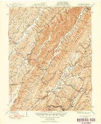
1949 Map of Warm Springs
USGS Topo · Published 1949About this map
Warm Springs and Hot Springs anchor this mountainous boundary region where Virginia meets West Virginia, shown here just after the second World War. The landscape is defined by the heavy ridges of the George Washington National Forest, including Warm Springs Mountain and Allegheny Mountain. Along the Jackson River, small clusters of settlement such as Bacova and Mitchelltown appear alongside rural landmarks like Mcclintic Bridge and the Thomastown Sch. Local history is preserved through numerous rural congregations and remote schools, including Zion Hill Ch, Westminster Church, and The Gap Sch. The map reveals a network of hollows and lick-named landmarks like Big Lick Hollow and Buck Lick Hollow, providing a detailed view of the terrain and settlement patterns that shaped these Appalachian communities before mid-century modernization.
Find a feature on this map
148 named features on this map. Tap any name to fly to it.
Don’t see what you’re looking for? This feature index may not catch every label — zoom into the map to look around manually.
Map Details
Editions of this 1949 Warm Springs Map
2 editions found
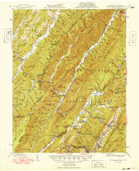
Other maps of this area

1887 · Lewisburg
USGS Topo · 1:125,000

1891 · Lewisburg
USGS Topo · 1:125,000

1891 · Huntersville
USGS Topo · 1:125,000

1894 · Huntersville
USGS Topo · 1:125,000

1894 · Natural Bridge
USGS Topo · 1:125,000

1901 · Monterey
USGS Topo · 1:125,000

1921 · Callaghan
USGS Topo · 1:48,000

1922 · Cass
USGS Topo · 1:48,000

1923 · Marlinton
USGS Topo · 1:48,000

1923 · Warm Springs
USGS Topo · 1:48,000