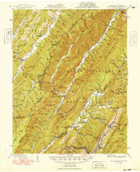
1949 Map of Warm Springs
USGS Topo · Published 1949About this map
Hot Springs and the surrounding resort landscapes of Bath County are central to this 1940s-era study of the Virginia-West Virginia borderlands. The map documents a deeply furrowed terrain defined by Allegheny Mountain and Warm Springs Mountain, where settlements are concentrated in the narrow valleys of Back Creek and the Jackson River. Local history is preserved in the numerous hollows and ridges bearing family names, such as Kellison Ridge and Stewart Hollow, indicating the early footprint of Appalachian homesteads.
Find a feature on this map
137 named features on this map. Tap any name to fly to it.
Don’t see what you’re looking for? This feature index may not catch every label — zoom into the map to look around manually.
Map Details
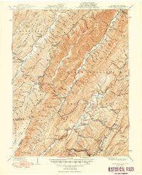
Editions of this 1949 Warm Springs Map
2 editions found
Other maps of this area

1887 · Lewisburg
USGS Topo · 1:125,000

1891 · Lewisburg
USGS Topo · 1:125,000

1891 · Huntersville
USGS Topo · 1:125,000

1894 · Huntersville
USGS Topo · 1:125,000

1894 · Natural Bridge
USGS Topo · 1:125,000

1901 · Monterey
USGS Topo · 1:125,000

1921 · Callaghan
USGS Topo · 1:48,000

1922 · Cass
USGS Topo · 1:48,000

1923 · Marlinton
USGS Topo · 1:48,000

1923 · Warm Springs
USGS Topo · 1:48,000