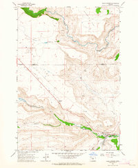
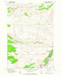
1963 Map of Warm Springs
USGS Topo · Published 1964About this map
Warm Springs serves as the focal point of this 1960s survey, situated at the confluence where Shitike Creek meets the valley floor within the Warm Springs Indian Reservation. The map documents the infrastructure of the era, including a Filtration Plant, Sewage Disposal, and the local Rodeo Grounds. Higher elevations like Schoolie Flat and Miller Flat are dissected by deep drainages such as Wolford Canyon, while numerous water sources like Kuckup Spr and Symentire Spring dot the landscape. Cultural markers such as the Bruno Cem and the small settlement at Wolford provide specific points of interest for genealogists and local historians. The transition from the high plateau down to the Warm Springs River reveals a complex network of unimproved roads and trails, including the Tenino Road, used for accessing the interior of the reservation.
Find a feature on this map
27 named features on this map. Tap any name to fly to it.
Don’t see what you’re looking for? This feature index may not catch every label — zoom into the map to look around manually.
Map Details
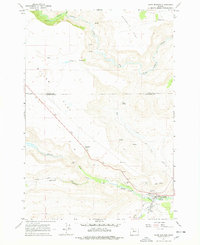
Editions of this 1963 Warm Springs Map
2 editions found
Other maps of this area

1928 · Madras
USGS Topo · 1:125,000

1931 · Madras
USGS Topo · 1:125,000

1955 · Bend
USGS Topo · 1:250,000

1957 · Bend
USGS Topo · 1:250,000

1958 · Bend
USGS Topo · 1:250,000

1962 · Metolius Bench
USGS Topo · 1:24,000
1962 · Simnasho
USGS Topo · 1:24,000
1962 · Hehe Butte
USGS Topo · 1:24,000

1962 · Eagle Butte
USGS Topo · 1:24,000
1962 · Seekseequa Junction
USGS Topo · 1:24,000