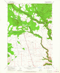
1962 Map of Hehe Butte
USGS Topo · Published 1964About this map
The Warm Springs Indian Reservation is the setting for this mid-century topographic study, defined by the sharp descent of the Warm Springs River as it carves through the volcanic plateaus of Wasco County. The landscape is marked by prominent high points like Hehe Butte and Simnasho Butte, which overlook a series of broad tablelands including Beaver Creek Prairie and Mill Creek Flat. Infrastructure of the era is evident in the managed water systems like the Mill Creek Canal and the presence of the Island Windmill near the horseshoe bend known as The Island. Roads such as Schoolie Road and Hehe Road provide limited access through the basin, while the Sidwalter Buttes stand as a southern landmark. This map captures a landscape transitioning between natural riparian corridors and early water-management projects.
Find a feature on this map
22 named features on this map. Tap any name to fly to it.
Don’t see what you’re looking for? This feature index may not catch every label — zoom into the map to look around manually.
Map Details
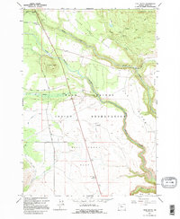
Editions of this 1962 Hehe Butte Map
2 editions found
Other maps of this area

1924 · Mount Hood
USGS Topo · 1:125,000

1927 · Mount Hood
USGS Topo · 1:125,000

1927 · Mt. Jefferson
USGS Topo · 1:125,000

1928 · Madras
USGS Topo · 1:125,000

1930 · Mt. Jefferson
USGS Topo · 1:125,000

1930 · Dufur
USGS Topo · 1:125,000

1931 · Madras
USGS Topo · 1:125,000

1934 · Dufur
USGS Topo · 1:125,000

1953 · The Dalles
USGS Topo · 1:250,000

1955 · Bend
USGS Topo · 1:250,000