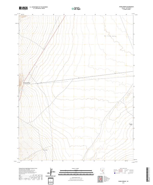
2021 Map of Warm Springs
USGS Topo · Published 2021About this map
Warm Springs serves as a central point in this high-desert landscape, where the intersection of state routes 6 and 375 provides access to the surrounding basins. This interior drainage environment is characterized by broad alluvial expanses like Hot Creek Valley and Reveille Valley, which are separated by shifting topographical gradients and canyon passages such as Cow Canyon. The presence of the Hot Spring near the primary settlement area indicates the geothermal activity common to this region of Nye County. The map details the vastness of the basin-and-range terrain, illustrating how sparse water sources and a few critical transit corridors dictate the pattern of human presence and movement through these open valley floors.
Find a feature on this map
15 named features on this map. Tap any name to fly to it.
Don’t see what you’re looking for? This feature index may not catch every label — zoom into the map to look around manually.
Map Details
Editions of this 2021 Warm Springs Map
This is the sole edition of this map. No revisions or reprints were ever made.
Other maps of this area

1956 · Tonopah
USGS Topo · 1:250,000

1959 · Tonopah
USGS Topo · 1:250,000

1962 · Tonopah
USGS Topo · 1:250,000

1967 · Lunar Crater
USGS Topo · 1:62,500

1967 · Buckwheat Rim
USGS Topo · 1:24,000

1967 · Tybo SE
USGS Topo · 1:24,000

1968 · Tybo
USGS Topo · 1:62,500

1968 · Warm Springs
USGS Topo · 1:62,500
1968 · Reveille
USGS Topo · 1:62,500
1968 · Warm Springs NW
USGS Topo · 1:24,000