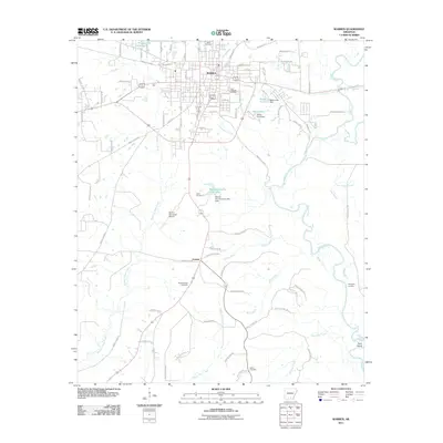
2011 Map of Warren
USGS Topo · Published 2011About this map
Warren sits as the central hub of this 2011 survey, a region where municipal development meets the winding waters of the Saline River. The landscape is defined by its drainages, with Town Branch and Carmichael Creek cutting through the local topography. To the south, the small settlement of Carmel anchors a rural intersection, while the Warren Municipal Airport serves as a modern landmark amidst the older patterns of land use.
Find a feature on this map
90 named features on this map. Tap any name to fly to it.
Don’t see what you’re looking for? This feature index may not catch every label — zoom into the map to look around manually.
Map Details
Editions of this 2011 Warren Map
This is the sole edition of this map. No revisions or reprints were ever made.
Other maps of this area

1934 · Ingalls
USGS Topo · 1:48,000

1937 · Ingalls
USGS Topo · 1:62,500

1939 · Ingalls
USGS Topo · 1:62,500

1953 · Greenwood
USGS Topo · 1:250,000

1953 · El Dorado
USGS Topo · 1:250,000

1956 · Greenwood
USGS Topo · 1:250,000

1957 · El Dorado
USGS Topo · 1:250,000

1958 · El Dorado
USGS Topo · 1:250,000

1960 · El Dorado
USGS Topo · 1:250,000
1971 · Hermitage
USGS Topo · 1:24,000