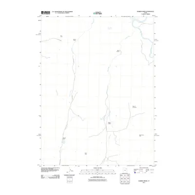
2011 Map of Warren Draw
USGS Topo · Published 2011About this map
Green River waters the northeastern corner of this remote Uintah County landscape, where deep erosional features define the drainage patterns of the high desert. The area is dominated by significant geographic depressions and passages, most notably the namesake Warren Draw and the winding Sears Canyon. Transport through this arid terrain is guided by established corridors such as Warren Draw Rd and Main Draw, which navigate between prominent elevations like Red Knoll and logical transit points at Felix Pass and Dead Horse Pass.
Find a feature on this map
18 named features on this map. Tap any name to fly to it.
Don’t see what you’re looking for? This feature index may not catch every label — zoom into the map to look around manually.
Map Details
Editions of this 2011 Warren Draw Map
This is the sole edition of this map. No revisions or reprints were ever made.
Other maps of this area

1885 · Ashley
USGS Topo · 1:250,000

1950 · Blair Basin
USGS Topo · 1:24,000

1952 · Warren Draw
USGS Topo · 1:24,000

1952 · Willow Creek Butte
USGS Topo · 1:24,000

1952 · Swallow Canyon
USGS Topo · 1:24,000

1952 · Clay Basin
USGS Topo · 1:24,000

1952 · Goslin Mtn
USGS Topo · 1:24,000

1954 · Vernal
USGS Topo · 1:250,000

1958 · Vernal
USGS Topo · 1:250,000

1960 · Vernal
USGS Topo · 1:250,000