1952 Map of Warren Draw
USGS Topo · Published 1975About this map
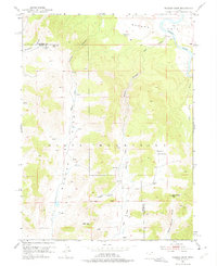
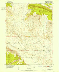
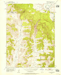
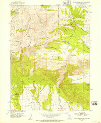
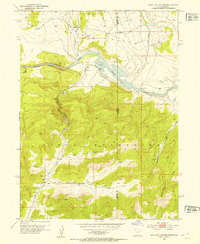
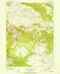
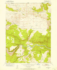
The Green River flows through the northeastern corner of this 1952 survey, marking the topographical shift toward the Uinta Mountains that dominate the southern half of the quadrangle. This area, located along the Daggett and Uintah County line, is defined by high-elevation drainage systems including Warren Draw, Sears Creek, and Tolivers Creek. The map records several named passes and hollows essential for navigating this high country, such as Dead Horse Pass, Felix Pass, and Wagon Hollow. These routes provided critical passage for movement between the river basin and the mountain interior. Remote water sources like Spitzenberg Spring and Sears Spring are documented alongside a Gaging Station and occasional Windmill sites, indicating the sparse but vital infrastructure required for ranching and resource management in the high desert at mid-century.
Find a feature on this map
28 named features on this map. Tap any name to fly to it.
Don’t see what you’re looking for? This feature index may not catch every label — zoom into the map to look around manually.
Map Details
Editions of this 1952 Warren Draw Map
2 editions found
Other maps of this area

1885 · Ashley
USGS Topo · 1:250,000
1950 · Blair Basin
USGS Topo · 1:24,000
1952 · Warren Draw
USGS Topo · 1:24,000
1952 · Willow Creek Butte
USGS Topo · 1:24,000
1952 · Swallow Canyon
USGS Topo · 1:24,000
1952 · Clay Basin
USGS Topo · 1:24,000
1952 · Goslin Mtn
USGS Topo · 1:24,000

1954 · Vernal
USGS Topo · 1:250,000

1958 · Vernal
USGS Topo · 1:250,000

1960 · Vernal
USGS Topo · 1:250,000