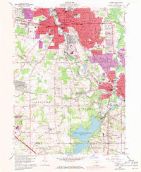
1959 Map of Warren
USGS Topo · Published 1971About this map
The industrial heart of the Mahoning Valley is captured during a period of transition in this mid-century survey, centered on the heavily developed corridor between Warren and Niles. The Mahoning River anchors the geography, flanked by a dense concentration of steel-era infrastructure including the Erie-Lackawanna, Baltimore and Ohio, and Penn Central rail lines. This 1971 photorevised edition highlights the expansion of the built environment into formerly rural patches of Howland and Weathersfield townships, while preserving the footprints of long-standing community landmarks like the Fairgrounds and Oakwood Cemetery.
Find a feature on this map
63 named features on this map. Tap any name to fly to it.
Don’t see what you’re looking for? This feature index may not catch every label — zoom into the map to look around manually.
Map Details
Editions of this 1959 Warren Map
4 editions found
Other maps of this area

1905 · Bristolville
USGS Topo · 1:62,500

1906 · Youngstown
USGS Topo · 1:62,500

1907 · Kinsman
USGS Topo · 1:62,500

1907 · Bristolville
USGS Topo · 1:62,500

1908 · Youngstown
USGS Topo · 1:62,500

1908 · Warren
USGS Topo · 1:62,500

1950 · Cleveland
USGS Topo · 1:250,000

1951 · Youngstown
USGS Topo · 1:24,000

1952 · Lake Milton
USGS Topo · 1:24,000

1952 · Canfield
USGS Topo · 1:24,000
Featured Places
- Warren, OH
- Weathersfield Township, OH
- Howland Township, OH
- Niles, Weathersfield Township
- Warren Township, OH