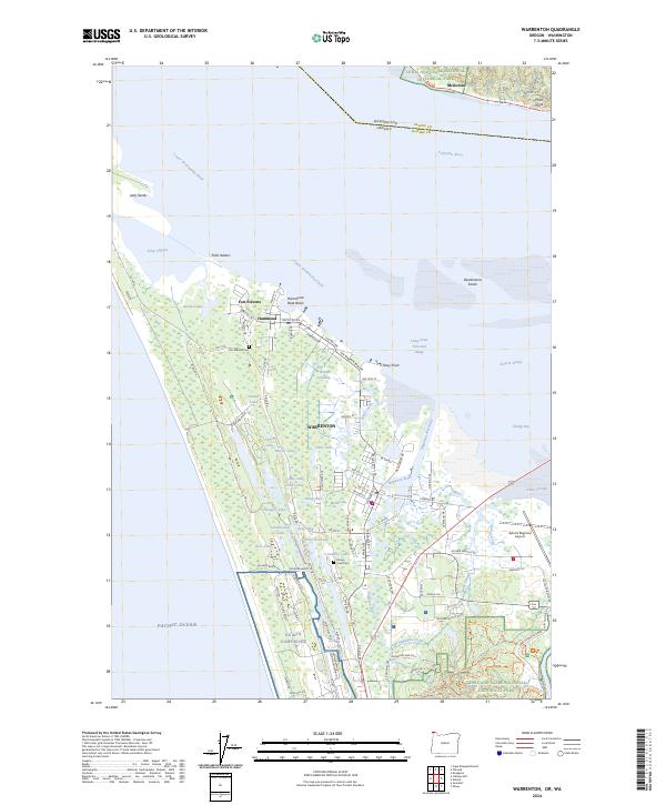
2024 Map of Warrenton
USGS Topo · Published 2024About this map
Fort Stevens and the adjacent military installations at Camp Rilea anchor this coastal landscape where the Columbia River meets the Pacific Ocean. This survey of Warrenton and Hammond highlights a complex network of coastal wetlands and small lakes, including distinctively named bodies like Creep and Crawl Lake, Wild Ace Lake, and Shag Lake. The area is defined by its strategic position at the river mouth, featuring the prominent Point Adams and the extensive Jetty Sands.
Find a feature on this map
71 named features on this map. Tap any name to fly to it.
Don’t see what you’re looking for? This feature index may not catch every label — zoom into the map to look around manually.
Map Details
Editions of this 2024 Warrenton Map
This is the sole edition of this map. No revisions or reprints were ever made.
Other maps of this area

1919 · Astoria
USGS Topo · 1:62,500

1938 · Cape Disappointment
USGS Topo · 1:62,500

1938 · Fort Columbia
USGS Topo · 1:62,500

1939 · Astoria
USGS Topo · 1:62,500

1943 · Fort Columbia
USGS Topo · 1:62,500

1943 · Copalis Beach
USGS Topo · 1:250,000

1949 · Astoria
USGS Topo · 1:24,000

1949 · Chinook
USGS Topo · 1:24,000

1949 · Knappton
USGS Topo · 1:24,000

1949 · Gearhart
USGS Topo · 1:24,000