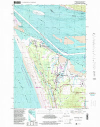
1996 Map of Warrenton
USGS Topo · Published 1999About this map
Fort Stevens and the surrounding Clatsop Plains dominate this coastal landscape where the Columbia River meets the Pacific Ocean. The map documents a critical maritime and military corridor, anchored by the Fort Stevens Military Reservation and the Point Adams Coast Guard Sta. Inland from the massive Clatsop Spit, the town of Warrenton is defined by its industrial and transit infrastructure, including the Skipanon Waterway, the Burlington Northern railroad line, and the Port of Astoria Airport.
Find a feature on this map
53 named features on this map. Tap any name to fly to it.
Don’t see what you’re looking for? This feature index may not catch every label — zoom into the map to look around manually.
Map Details
Editions of this 1996 Warrenton Map
This is the sole edition of this map. No revisions or reprints were ever made.
Other maps of this area

1919 · Astoria
USGS Topo · 1:62,500

1938 · Cape Disappointment
USGS Topo · 1:62,500

1938 · Fort Columbia
USGS Topo · 1:62,500

1939 · Astoria
USGS Topo · 1:62,500

1943 · Fort Columbia
USGS Topo · 1:62,500

1943 · Copalis Beach
USGS Topo · 1:250,000

1949 · Astoria
USGS Topo · 1:24,000

1949 · Chinook
USGS Topo · 1:24,000

1949 · Knappton
USGS Topo · 1:24,000

1949 · Gearhart
USGS Topo · 1:24,000