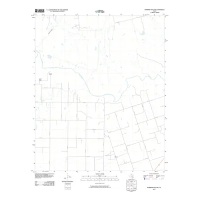
2010 Map of Warrior Hollow
USGS Topo · Published 2010About this map
Pease River meanders across this rural Hardeman County landscape, carving a wide valley floor flanked by the distinct drainage of Warrior Hollow. In the early 21st century, the region remains defined by its sparse, grid-based road network and long-standing rural community markers. The map serves as a vital record for genealogists, pinpointing the Margaret Cemetery in the northwest and Thalia Cemetery to the southeast, both critical landmarks for tracing local family histories.
Find a feature on this map
29 named features on this map. Tap any name to fly to it.
Don’t see what you’re looking for? This feature index may not catch every label — zoom into the map to look around manually.
Map Details
Editions of this 2010 Warrior Hollow Map
This is the sole edition of this map. No revisions or reprints were ever made.
Other maps of this area

1954 · Wichita Falls
USGS Topo · 1:250,000

1955 · Lawton
USGS Topo · 1:250,000

1958 · Wichita Falls
USGS Topo · 1:250,000

1958 · Vernon
USGS Topo · 1:62,500

1958 · Medicine Mound
USGS Topo · 1:62,500

1966 · Crowell
USGS Topo · 1:24,000

1966 · Thalia
USGS Topo · 1:24,000
1966 · Santa Rosa Lake NW
USGS Topo · 1:24,000

1983 · Warrior Hollow
USGS Topo · 1:24,000

1983 · Tolbert
USGS Topo · 1:24,000