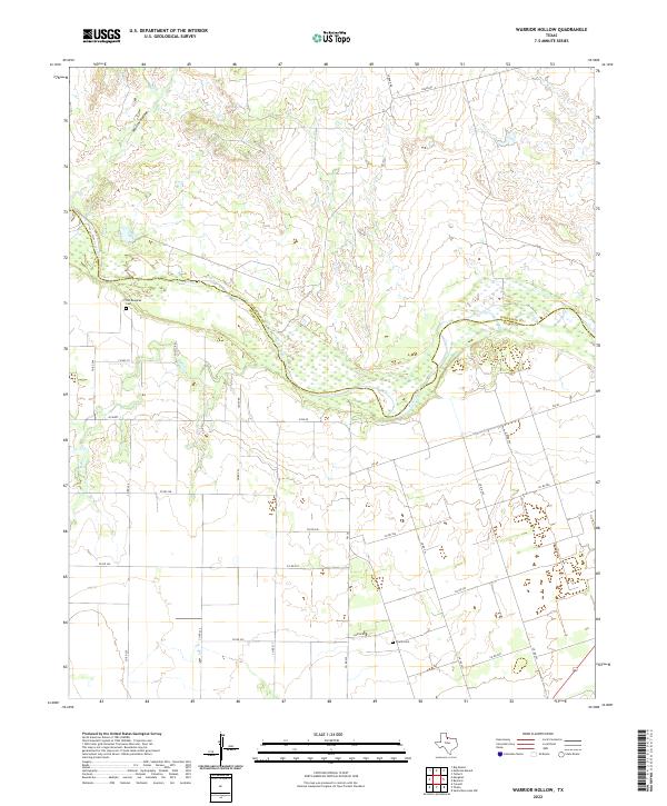
2022 Map of Warrior Hollow
USGS Topo · Published 2022About this map
The Pease River defines the landscape as it winds across the northern half of this terrain, marking the boundary between Hardeman and Foard counties. This particular stretch of the river valley is flanked by drainage systems like Mule Cr and the topographical depression known as Warrior Hollow. The map reveals a rural grid of county roads that speak to the region's agricultural layout, with Sandy Rd and FM 98 providing primary access through the undulating plains.
Find a feature on this map
31 named features on this map. Tap any name to fly to it.
Don’t see what you’re looking for? This feature index may not catch every label — zoom into the map to look around manually.
Map Details
Editions of this 2022 Warrior Hollow Map
This is the sole edition of this map. No revisions or reprints were ever made.
Other maps of this area

1954 · Wichita Falls
USGS Topo · 1:250,000

1955 · Lawton
USGS Topo · 1:250,000

1958 · Wichita Falls
USGS Topo · 1:250,000

1958 · Vernon
USGS Topo · 1:62,500

1958 · Medicine Mound
USGS Topo · 1:62,500

1966 · Crowell
USGS Topo · 1:24,000

1966 · Thalia
USGS Topo · 1:24,000
1966 · Santa Rosa Lake NW
USGS Topo · 1:24,000

1983 · Warrior Hollow
USGS Topo · 1:24,000

1983 · Tolbert
USGS Topo · 1:24,000