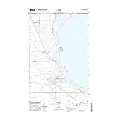
2016 Map of Warroad
USGS Topo · Published 2016About this map
Warroad sits at the southwestern edge of Lake of the Woods, where the Warroad River meets the expansive Muskeg Bay. This 2016 survey documents the community's layout and its connection to the surrounding landscape, including the Warroad International Memorial Airport and several residential areas branching off from Co Hwy 74. The international boundary with Canada is marked at Elm Point and across the northern waters, emphasizing the town's role as a border community. Genealogists and local historians can locate established landmarks such as Saint Marys Cem and Riverside Cem situated south of the main settlement. Further north along the shoreline, Springsteel Island and the small settlement of Longworth illustrate the recreational and rural patterns of Roseau County. The map provides a detailed view of the local street grid, featuring names like Steenerson St NE and Garfield St SW, which help define the town's growth relative to the lake shore.
Find a feature on this map
55 named features on this map. Tap any name to fly to it.
Don’t see what you’re looking for? This feature index may not catch every label — zoom into the map to look around manually.
Map Details
Editions of this 2016 Warroad Map
This is the sole edition of this map. No revisions or reprints were ever made.
Other maps of this area

1918 · Buffalo Bay
USGS Topo · 1:62,500

1918 · Roosevelt
USGS Topo · 1:62,500

1918 · Warroad
USGS Topo · 1:62,500

1943 · Roosevelt
USGS Topo · 1:62,500

1943 · Warroad
USGS Topo · 1:62,500

1954 · Roseau
USGS Topo · 1:250,000

1957 · Roseau
USGS Topo · 1:250,000

1958 · Roseau
USGS Topo · 1:250,000

1963 · Kenora
USGS Topo · 1:250,000

1967 · Roosevelt NW
USGS Topo · 1:24,000